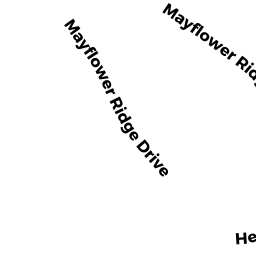
97 MAYFLOWER RIDGE DR
Owner Information
LEVY DANA L
375 WELLINGTON RD
DELMAR, NY 12054


Property Details
97 MAYFLOWER RIDGE DR is classified as a Potentially Developable Residential Land (Vacant land).
97 MAYFLOWER RIDGE DR is valued at $19,700. The land is valued at $19,700 and the structures are valued at $0.
This property is in Zone MR30. Confirm with local Zoning Board authorities to ensure there are no overlays or other easements on this property.
The most recent deed for 97 MAYFLOWER RIDGE DR is recorded at the local registrar in Book 36123, Page 0239. 97 MAYFLOWER RIDGE DR was last sold on Friday, June 27, 2008 for $275,000.
Assessment data from fiscal year 2022.
Flood Data
This property is completely within the AE Zone (within floodplain).
The base flood elevation for this flood zone is 14 feet.
This information is sourced from the FEMA National Flood Hazard Layer. See our full disclamer.
Broadband Internet Providers
| Provider | Type | Bandwidth (mbps) | |
|---|---|---|---|
| Viasat Inc | Satellite | 35 | 3 |
| Verizon New England Inc. | DSL | 5 | 0 |
| Verizon New England Inc. | Fiber | 940 | 880 |
| Comcast | Cable | 1000 | 35 |
| T-Mobile | Fixed Wireless | 25 | 3 |
| GCI Communication Corp. | Satellite | 0 | 0 |
| HughesNet | Satellite | 25 | 3 |
| VSAT Systems, LLC. | Satellite | 2 | 1 |
Broadband service provider data from December 2020.
Adjacent Properties
- 0 MAYFLOWER RIDGE DR
Undevelopable Residential Land owned by COMMUNITY GARAGE INC - 99 MAYFLOWER RIDGE DR
Single Family Residential owned by GORMAN DALE J - 117 MAYFLOWER RIDGE DR
Single Family Residential owned by MACKAY JULIA A - 0 TERRY LN
Improved, Selectmen or City Council (Municipal) owned by TOWN OF WAREHAM - 0 FONSECA WY
Undevelopable Residential Land owned by CORNERSTONE ESTATES 2